
Clifton Street Address Walkthrough
The strongest Clifton by-address trail starts with the exact property location. The Clifton assessor can return an ownership and assessment record, while the county parcel layer supplies the mapped parcel and legal identifiers. Those identifiers then make it easier to search Clifton recorded documents. A deed can show parties to a transfer, but it does not establish every person who lived there. Historical Clifton directories can add a dated street or household reference, although their regional titles and gaps require care.
- Enter the address in the Clifton assessment search. Save the Clifton property location, owner, block, lot, qualifier, and mailing address as separate fields.
- Open the Clifton parcel in the Passaic County GIS viewer or parcel service. Copy the PAMS PIN, municipality code, block, lot, and any displayed deed fields.
- Search the same Clifton block and lot in the Passaic County Clerk’s PRESS index. Review the newest recorded deed before treating an assessor listing as current ownership.
- Use a specific Clifton Building Department or OPRA request for dated permit or certificate records when that address evidence is needed. No public citywide permit search was located.
- For an older Clifton address, ask the library or historical society for regional directory and street-section material. Compare each dated entry with the parcel identifiers.
New Jersey’s voter-registration check confirms registration status, but the live form was blocked during inspection and no public Clifton street-browse field was verified. A Clifton election-district list request goes through the elections custodian under the state’s list-copy rules, not through a general street-directory search.
Clifton Street Assessor Search
Clifton’s TaxRecords-NJ assessment search is the practical first stop for a known Clifton street. It uses Clifton district 1602 and lets a researcher choose either the Current Owners/Assmt List or the Deed/SR1A List. Simple search accepts Location, Owner Name, Block, Lot, and the portal’s spelled-as-shown “Qualifer” field. Advanced search adds Street Addr and City. Select a single-line, multi-line, or Excel output before running a longer Clifton street result.
| Assessor control | Use for a Clifton street search | Research note |
|---|---|---|
| Location or Street Addr | Enter an address or street text, then add City in advanced mode. | Exact matching behavior was not stated. |
| Owner Name | Check surnames and entity spellings after finding a parcel. | Useful for joining a property record to a deed search. |
| Block, Lot, Qualifer | Carry the values into GIS and PRESS. | Clifton blocks may include decimals, such as 69.01. |
| Output and page size | Choose single line, multi-line, or Excel. | Visible page options run from 10 to 1,000 rows. |
The captured Clifton assessor search shows the simple controls used to begin a by-address query.
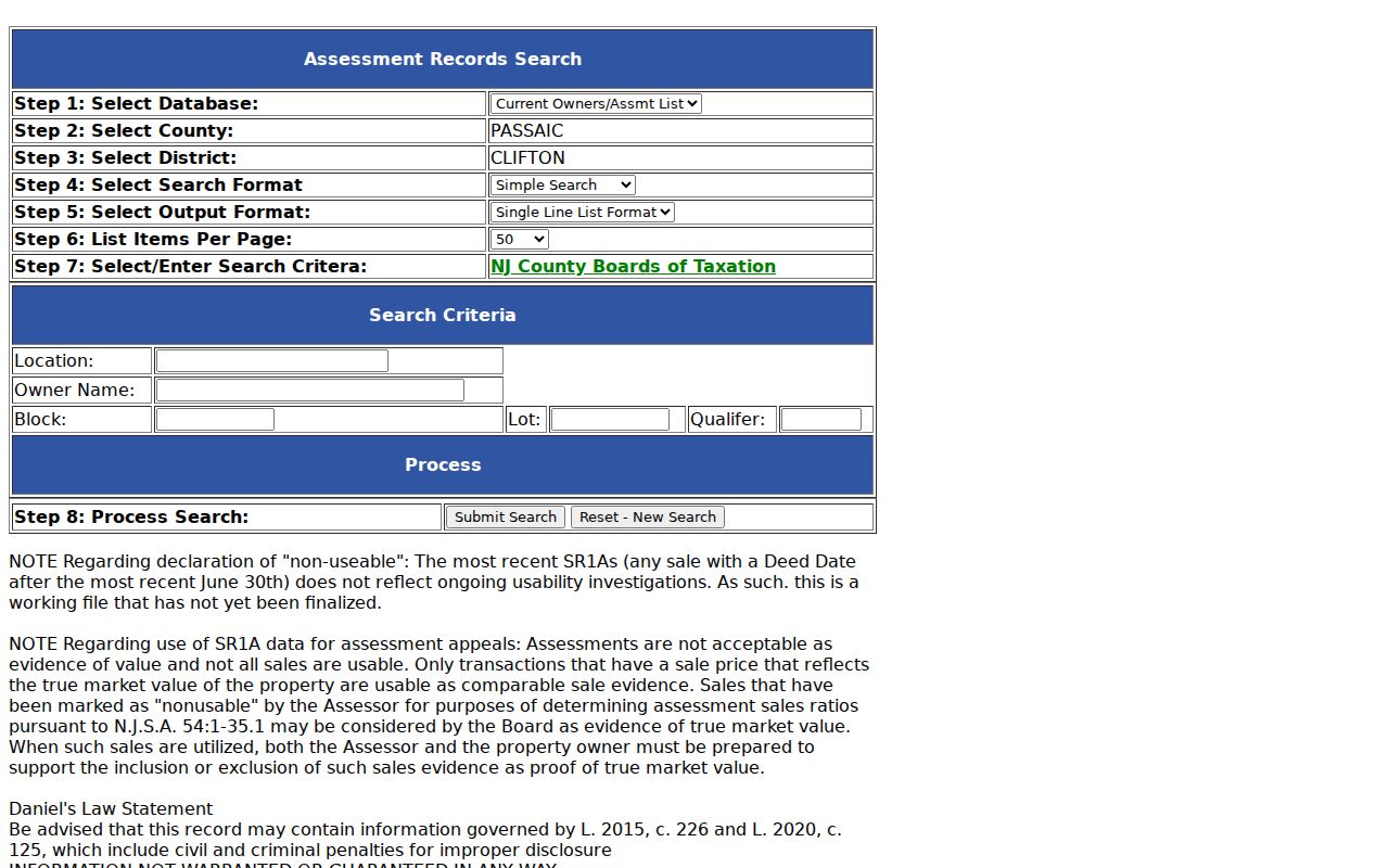
The Clifton result is an assessment and ownership lead, not a certified value opinion or a complete resident list. Preserve both the Clifton property location and the tax mailing address because they can differ.
Clifton Street Advanced Fields
Clifton advanced assessor mode is useful when a location field needs more structure. It provides Street Addr and City fields, property-class choices, sale-date options, Book and Page fields, and numeric ranges for year built, size, land, improvements, net value, and sale price. The same output modes and page-size controls remain available. No ZIP field was visible in the inspected advanced controls, so a Clifton street result should be narrowed with the address or parcel identifiers instead.
The captured advanced assessor screen records the City, class, sale-date, value, and date-range controls used for Clifton property research.
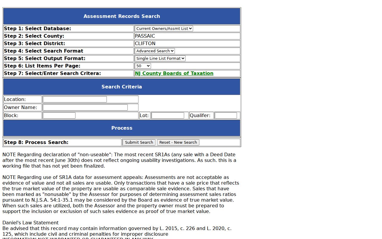
Use the displayed City as a Clifton municipal text field, not as a postal boundary. For a Clifton by-address trail, carry the resulting block, lot, qualifier, and property location forward to GIS and PRESS.
Clifton Street Parcels in GIS
The Passaic County GIS parcel service turns a Clifton street result into a mapped Clifton property feature. Its visible identifiers include PAMS_PIN, PCL_MUN, PCLBLOCK, PCLLOT, PCLQCODE, PIN_NODUP, and GIS_PIN. The same feature can show a property location, mailing-address fields, ZIP fields, values, land description, and some deed or sale fields. The REST service supports geometry and spatial queries, so adjacent Clifton parcel shapes can be checked without assuming the street number alone tells the story.
| Parcel bridge | PAMS PIN, municipality code 1602, block, lot, and qualifier connect the map to assessor and clerk searches. |
|---|---|
| Address fields | PROP_LOC is the property location; ST_ADDRESS and CITY_STATE can be mailing data; ZIP_CODE, ZIP5, and ZIP_PLUS4 are available fields. |
| Map caution | The county describes GIS parcels as a planning representation, not a survey, official tax map, or deed substitute. |
Click the target Clifton polygon, then compare the returned block and lot with the Clifton assessor. If a GIS owner name is blank, do not infer an owner from a nearby label. Hosted parcel products can omit or redact owner information, including through Daniel’s Law privacy treatment.
Clifton Street Directory Record Coverage
Different Clifton records answer different address questions. Clifton assessment data is strongest for the current tax parcel. Clifton GIS supplies the spatial and parcel context. Clifton PRESS records transfers and instruments. Clifton city requests can supply a dated construction or public-meeting record. None substitutes for another, and none should be described as a street-by-street household roster.
| Address record | Custodian | What it can establish | Access route |
|---|---|---|---|
| Assessment list | Clifton Tax Assessor | Owner, situs, mailing address, block/lot, class, values, and deed/SR1A leads | Public simple or advanced portal; 10 to 1,000 row output |
| Parcel GIS | Passaic County GIS | Parcel geometry, PAMS PIN, address, ZIP, use, values, and some deed fields | Public viewer or REST query; owner can be blank or redacted |
| Recorded documents | Passaic County Clerk, PRESS | Grantor, grantee, instrument, date, book/page, and legal-description leads | Free index and first page online; Record Room for fuller work |
| Filed maps and street records | County Clerk and Clifton Engineering | Lot lines, subdivisions, rights-of-way, dedications, and street vacations | PRESS, official map resources, or city contact |
| Permits and certificates | Clifton Building Department | Construction, alteration, occupancy, inspections, or named applicant | Department contact or address-specific OPRA request |
When a search goal changes from an address trail to a single person, the Clifton resident lookup offers a separate verification route. The property and street records remain useful corroboration, but they should not be stretched into proof of identity or occupancy.
Clifton Street Transfers in PRESS
Passaic’s Public Records Electronic Search System, known as PRESS, is the recorded-document layer for a Clifton by-address trail. Search its Clifton Block/Lot tab with municipality and date range, or use the Name tab after the assessor identifies a Clifton owner. Its Document Type tab includes deeds, mortgages, filed maps, rights-of-way, street vacations, liens, and other registry instruments. A Clifton address may not appear in an older deed, so the legal block and lot often matter more than modern wording.
The captured PRESS search page displays the municipality, document, date, block/lot, name, and instrument search paths.
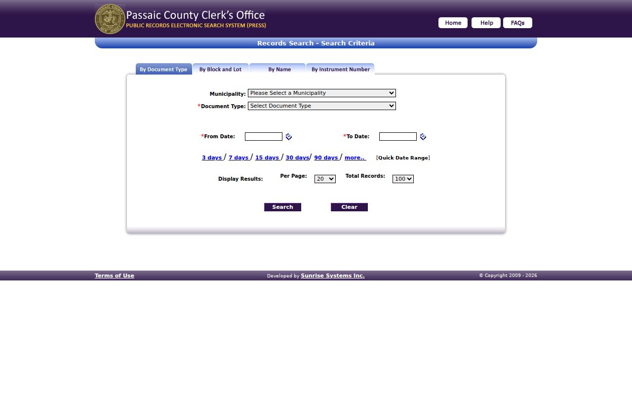
PRESS has an online index from December 1, 2000 to the present. Deed and mortgage images begin January 1, 1989, while older conversion remains incomplete. The free public tier provides the index and first document page; complete older records, certified copies, and title work belong with the County Clerk’s Registry Division Record Room. The Clerk does not perform title searches.
Clifton Street Address Dates
Clifton’s Building Department can hold permit jackets, certificates of approval or occupancy, inspections, and related Clifton address evidence. Its public online permit search was not located. Request only a defined record by giving the exact Clifton address, block and lot, record type, and date range through the department or Clifton’s OPRA process. A permit can date work, demolition, an addition, or a change of use. It does not automatically prove current ownership or identify every person connected with the site.
Clifton Engineering also maintains street, subdivision, sewer-record, and official tax-assessment maps. It does not maintain individual-property survey maps. For a line or street discrepancy, compare the official tax map, filed map, deed description, parcel GIS, and assessor record rather than relying on a general web map.
Note: A specific address request is more likely to reach the relevant record than a broad request for all files along a Clifton street.
Clifton Street Record Terms
Property records use a few terms that are easy to confuse when searching a Clifton address.
- Parcel
- A mapped unit of land used in the tax and GIS systems. It is identified by municipality, block, lot, and sometimes qualifier.
- Situs address
- The physical property location. It differs from the mailing address when tax notices go elsewhere.
- Plat or filed map
- A recorded map that can show lot lines, subdivision layout, or street-related changes. It is not an individual survey.
- Criss-cross directory
- A historical directory arranged by address or street, used to look for a dated occupant or business reference.
Clifton Street Place Labels
Older street research needs local vocabulary. Clifton became an incorporated city in 1917 from the Acquackanonk Township area. Earlier deeds, directories, maps, and news can use Acquackanonk, Clifton village, or nearby place labels instead. The city’s 1913 historical-news collection records debate over annexation of parts of Acquackanonk Township and names Clifton, Delawanna, Richfield, Albion Place, Athenia, Lakeview, and Botany. A different label is a search lead, not proof that a property moved.
This local record-keeping story matters when a by-address search reaches a regional volume or a legal description without a modern city name. Check the old label against the block and lot, a filed map, and the historical street index before merging it with a present-day Clifton address.
Clifton Street History Leads
Regional city directories can supply older address snapshots, but their coverage is irregular. The documented runs include 1899, early 1900s regional volumes, W.L. Richmond titles from 1907 through 1918, later 1924 to 1930 volumes, and selected 1937 to 1960 holdings with gaps. The Clifton Public Library and Passaic County Historical Society are the key access channels, with digitized material and licensed databases available in some cases. Ask for street or address sections rather than assuming a name-only index will answer the question.
A historical entry may use shorthand such as “h,” “wid,” or “do,” and its address can be paired with a Passaic business notation or neighboring-place heading. Read the page image when possible because OCR can misread initials, street numbers, and names. The historical collection itself is covered in more depth on the Clifton city directory.
Clifton Street Directory Limits
A property owner is not necessarily an occupant. Tax mailing addresses can point to a post-office box, estate representative, business, or another address. Other occupants, family members, and boarders do not appear as a complete public list in assessor, deed, or GIS records. Utility customer data and motor-vehicle addresses are not public street-directory sources. Protected addresses can also be substituted or redacted through New Jersey’s Address Confidentiality Program or Daniel’s Law.
Use each official source for the limited fact it records, and confirm an important ownership question with the County Clerk or other custodian. A blank field is a data-scope or privacy signal, not a reason to guess.